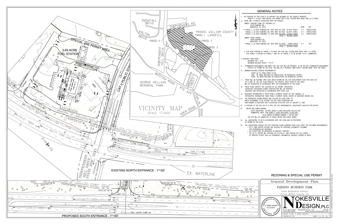
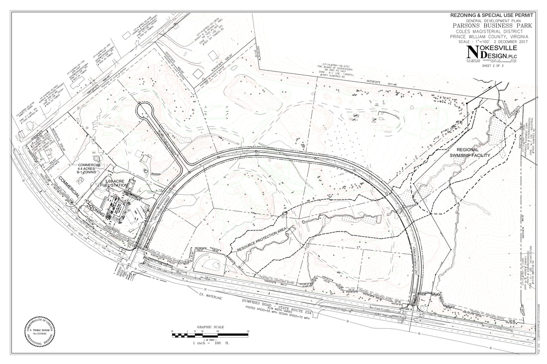
Parsons Business Park
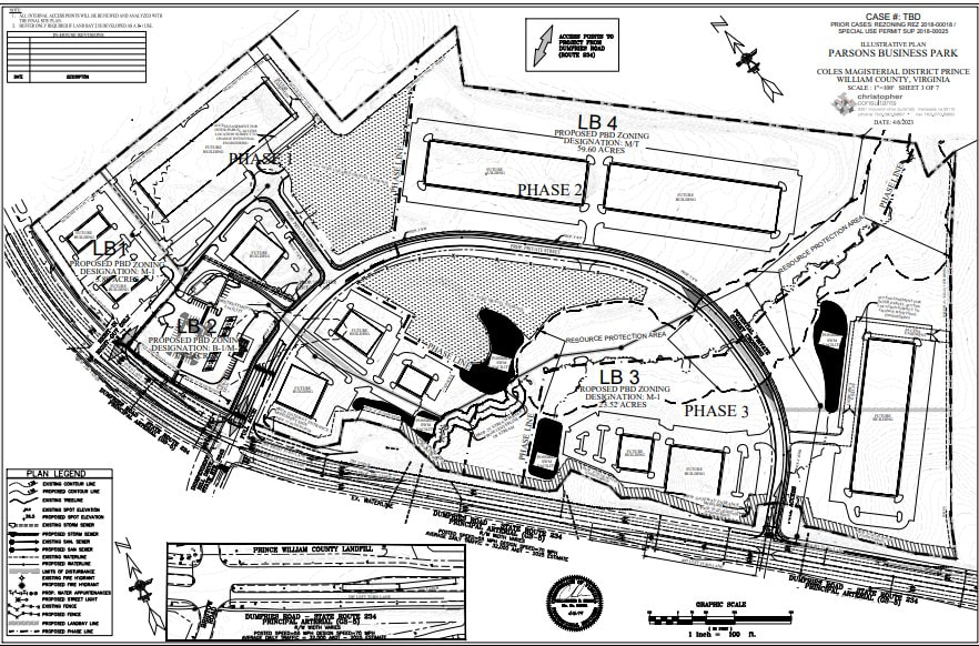
9-30-23: The applicant has applied to amend the proffers on the project to allow for an increase in the maximum height for data center buildings up to 80 feet, to change the land use designation in Land Bay 2 to allow B-1 (General Business) / M-1 (Heavy Industrial) uses, and with other associated development waivers and modifications. More info:
| planning-_review_package_s1_-_parsons_business_park_pra_2023_0622.pdf |
New layout with data centers
This proposal is for a new business park located on the site of the current Parsons Farm location on Rt. 234 that sells mulch, gravel, etc. Below is a link to more information and layouts for the gas station and business park. Recent adjustments have included the elimination of the tractor-trailer refueling capability, the addition of a car wash, and a proffered sidewalk along Rt. 234.
| planning-1st_submission_materials-parsons_business_park-2018_0302.pdf |