The Geisler Project
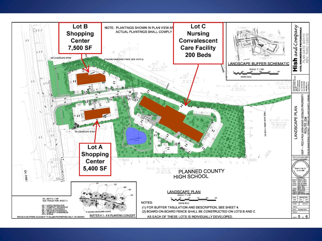
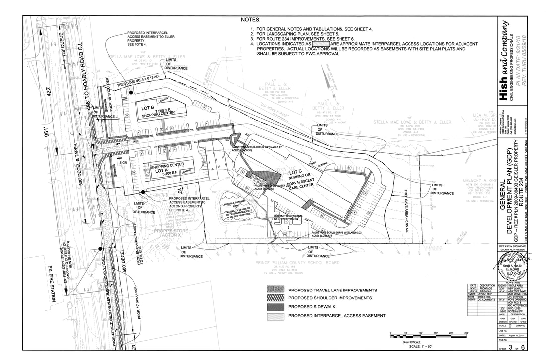
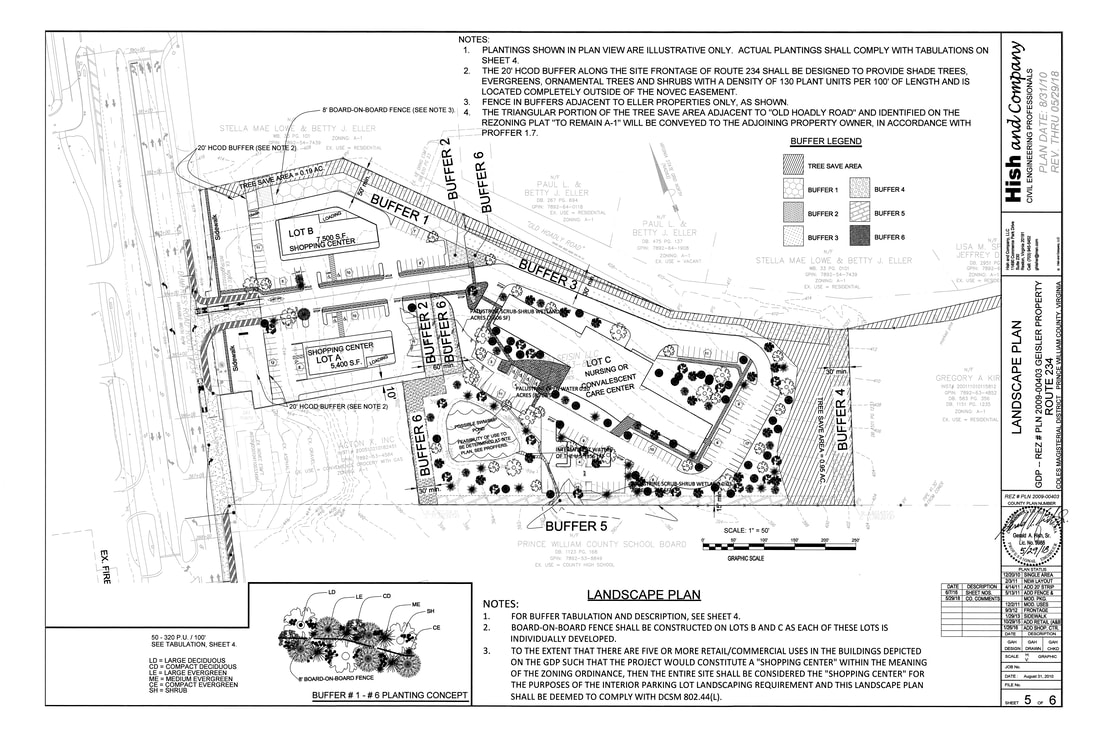
The latest (current) plan is above. This version has no gas station, no fast-food restaurants and two retail centers facing each other perpendicular to Rt. 234. The Planning Commission at their July, 2019 meeting recommended that the applicant remove the commercial space from the project. This application goes to the BOCS for a public hearing on 9/17/19.
Earlier information:
This is an application to develop a parcel of land near the corner of Rt. 234 and Hoadly Road. It is approximately 9 acres and is currently zoned A-1, which in this case means it has never been rezoned since the county Comprehensive Plan was initiated. The front part of the parcel carries the Neighborhood Commercial (NC) Long Range Future Land Use Classification (“FLUC”), while the rear portion of the Property is located in the Semi-Rural Residential Future Land Use Classification. The purpose of the NC classification is to provide commercial areas to serve the surrounding residential neighborhoods. The purpose of the SRR classification is to provide for areas where a wide range of larger lot residential development can occur, as a transition between the largest lot residential development in the rural area of the County and the more dense residential development found in the developed areas of the County. Residential development in the SRR areas occur as single- family dwellings at a density of one dwelling per 1 to 5 gross acres, with an average density of 2.5 acres per dwelling.
This project has been presented to MIDCO previously. The first iteration featured a nursing home, a gas station, and a fast-food restaurant with a drive-thru. That was revised with a plan including a fast-food restaurant, a small strip-shopping center, the nursing home and no gas station. The latest version (1/7/12) brings back the gas station, drops the strip-shopping center, replacing it with a freestanding full service restaurant, and retains the nursing home. Details on the project are available below.
| Written Narrative |
| Plan Details |
12/11/12 Update: This project was recommended for approval at the Planning Commission level. The scheduled December Board of County Supervisors public hearing was deferred at the request of the applicant.
Community concerns continue to involve traffic issues (including 10,000 more vehicle trips per day), installation of another gas station in an area with three already, and general project intensity issues.
1/5/13 Update: A community meeting was held at the Coles District Fire Station with over 150 residents in attendance. Developer representatives, county supervisor Marty Nohe, meeting organizer Jim Zell, and MIDCO president Martin Jeter were present. A presentation of the proposed project was given by Mike Vanderpool, who was representing the applicant. Many concerns were heard from the community, mostly centering around traffic issues and the questionable need for another gas station. The project has been taken off of the February Board of County Supervisors agenda and more community meetings are planned.
5/20/14 Update: This project has been put on hold by the developer.