Mid County Civic Association Of Prince William
  • Home
    • Contacts
    • FOCAL
  • Our Board
  • Current Projects
    • Purcell Road East/ Peaks Mill Road
    • Kline Property
    • Delaney Tract
    • Government Complex Activity Center
    • Kings Crest
    • Data Center Overlay
    • Comprehensive Plan Map Changes
    • Land Use Chapter Update
    • Environmental Impacts Of AAOD, etc.
    • Dumfries Road Senior Residential (ex Geisler Project)
    • Distribution Center Overlay District
    • Primeland Retail
    • Cows On Less Than 10 Acres
    • Domestic Fowl Overlay District Expansion
    • Agritourism and Arts Overlay District Draft
    • The Preserve At Long Branch
    • International Central Gospel Church (Transformational Temple)
    • Old Bridge/ Prince William Parkway Intersection
    • Purcell Road Project
    • Estates At Bren Landing
    • New Parkway/ Brentsville Road Intersection
    • St. Margaret's Parcel
    • Reserve At Long Forest
    • Elm Street Independent Hill
    • 14th High School Site
    • Small Area Plans >
      • Independent Hill
    • Dar Alnoor Expansion
    • McCoart Redevelopment >
      • Community Ideas For McCoart
    • SRR Language
    • Rural Crescent Study
    • Quartz District
    • English Gardens Project
    • Liberia Avenue (Aksoylu) Project
    • MGM Office Building
    • Potomac Corners
    • Mid County Park and Estate Homes
    • Davis Ford Park
    • Strategic Plan
    • Bacon Race Fire & Police Station
    • Urban Development Areas
    • Signal Hill Area
    • Davis Ford Gateway
    • Data Center ZTA
    • Occoquan Tourist Information Center
    • Occoquan Overlay Committee Report >
      • Letter From Staff On Overlay District
  • Meeting Minutes
  • Mid-County History
    • How Prince William Grew
    • Priest's Mill
    • Dumfries Road and Brentsville
    • Davis Ford Road
    • Civil War
    • Red House Pictures
    • Cemeteries
    • Worship as you Please
  • Older Projects
    • Parsons Business Park
    • Geisler Project
    • Carter's Grove
    • Chinn Park Cell Tower
    • Chinn Park School
    • Hoadly Falls Project
    • Government Center Professional Building Electronic Sign
    • Apollo Project
    • Davis Ford Sewer and Water Line
    • Cayden Ridge
    • Richmond Station
    • Pyramid Center
    • Montessori Farm School
    • Mallard North and South
    • Motor Vehicle Zoning Text Amendment
    • Purcell Road Planning Commission Hearing
    • Purcell Road Letter To BOCS
    • Purcell Road PC Work Session Report
    • Hunters Ridge Proffers
  • Blog
Picture
Picture
Picture
Picture
Picture
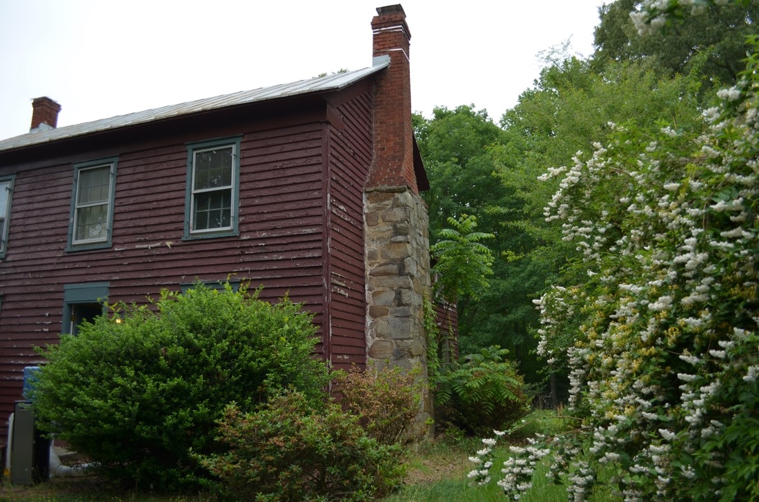
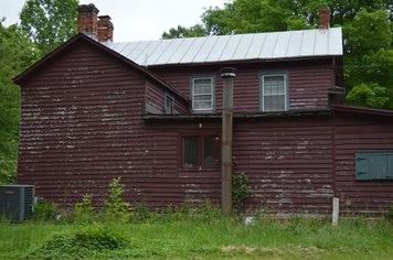
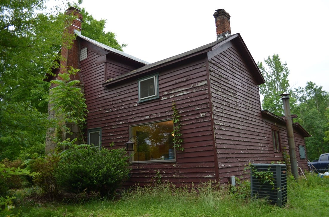
The house was most likely constructed about 1860 and the addition housing the kitchen, bathroom and porch (one story section at top left) was added later- possibly in the 1950's. Note the stone/brick fireplace above- it still works!
Picture
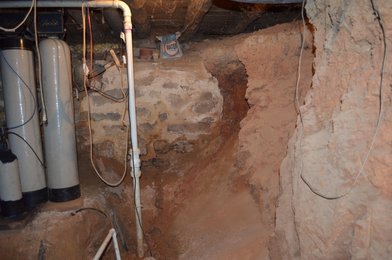
 Hand dug basement at left, probably done     later (1950's?) to accommodate HVAC and water equipment.

Picture
Picture
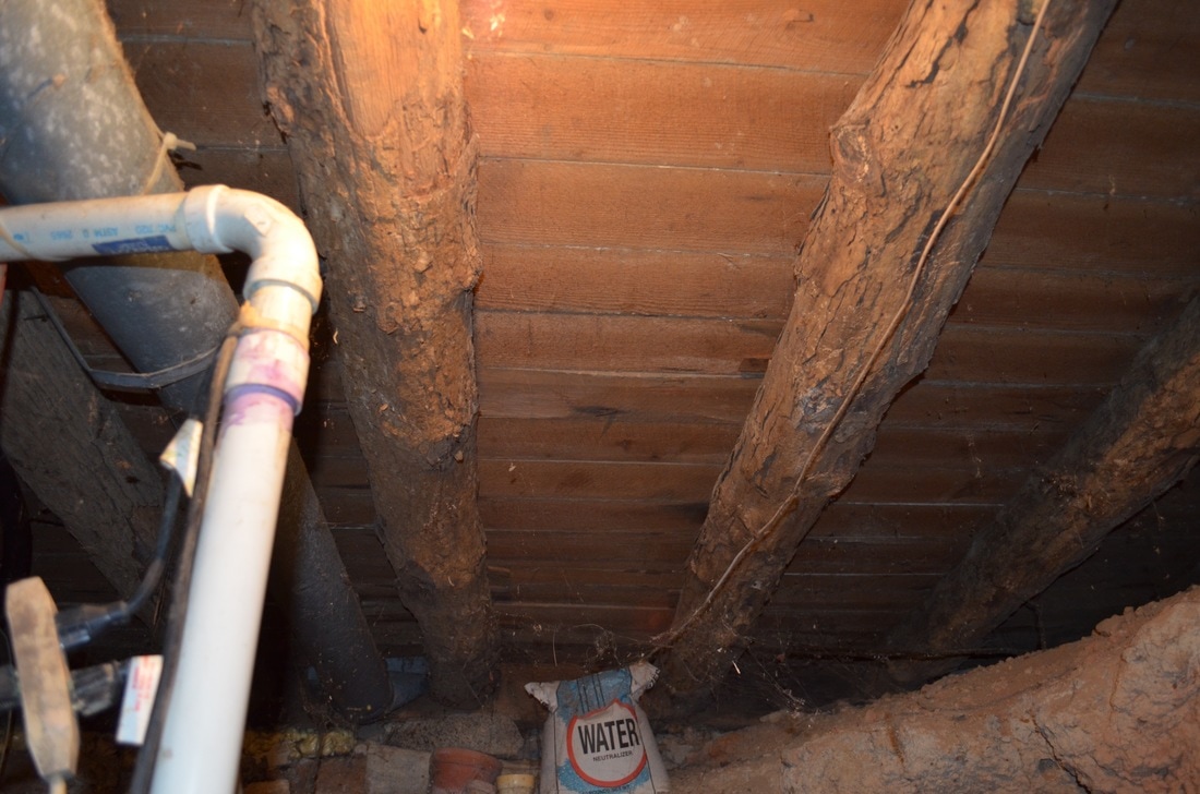
  Floor beams with the bark still on them at left and above.

Picture
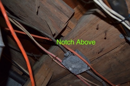
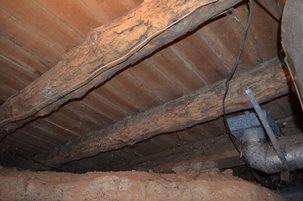
                                                                                                              Detail of the notching that was used to connect the floor "logs" to the main beam at right. Main beam is hand-hewn. Hand-cut nails are visible in the main stairway.

Picture


​

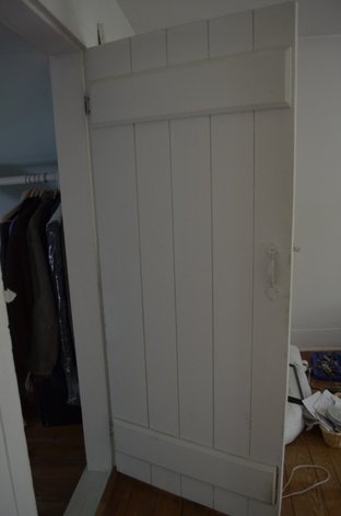
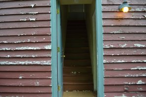
​Interior door- probably original.

Picture


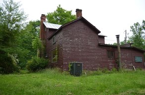
A Civil War skirmish happened near this house, and it is reputed to have been used as a hospital during the war. The house stands near the intersection of two important roads from the period, and down the hill towards the Occoquan River is a Confederate gun emplacement and a separate breastworks. If only this house could talk!
Proudly powered by Weebly