International Central Gospel Church (Transformational Temple)
Latest submission with revised entrance design:
| planning-_review_package_s5-_transformation_temple_international_church_sup2023_0118.pdf |
Latest changes dated 8-16-22
Immediately below is an update to the plan submitted in late January 2022. Changes include a request for a 6-foot tall by 12-foot wide electronic sign, and a revised entrance design.
| 7._international_central_gospel_church_sup_plan_11-3-21.pdf |
| 2._written_narrative_-_icgc_1-31-22.pdf |
| 3._proposed_conditions_1-31-22.pdf |
| 6._response_to_pwcdot_comments_1-31-22.docx |
| 4._response_to_county_comments_1-31-22.pdf |
| icgc_power_point_for_11-18-21_meeting.pptx |
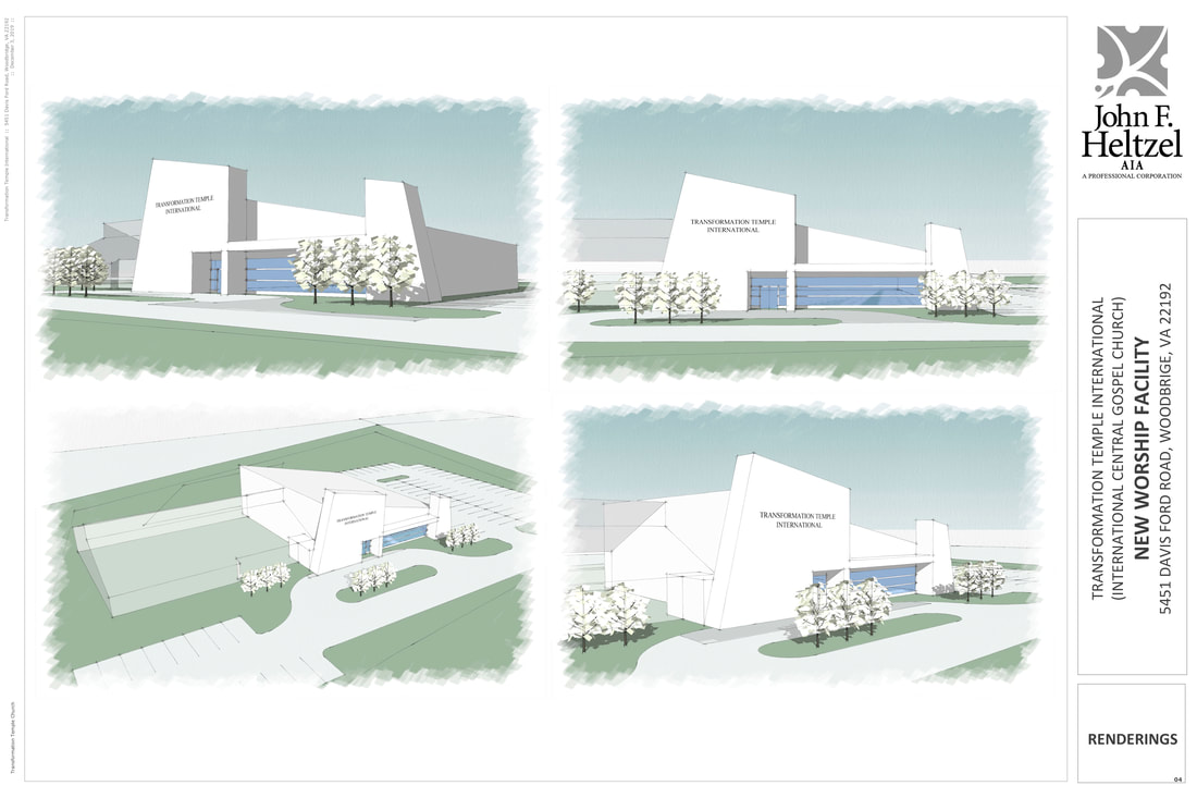
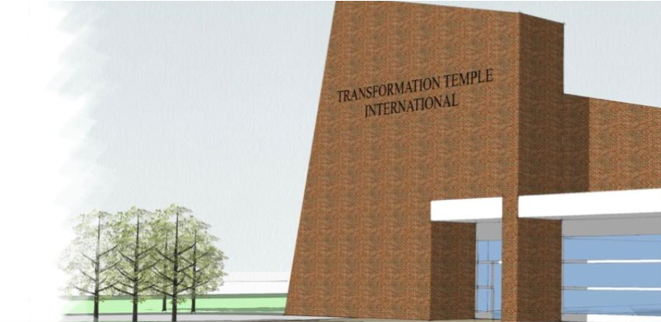
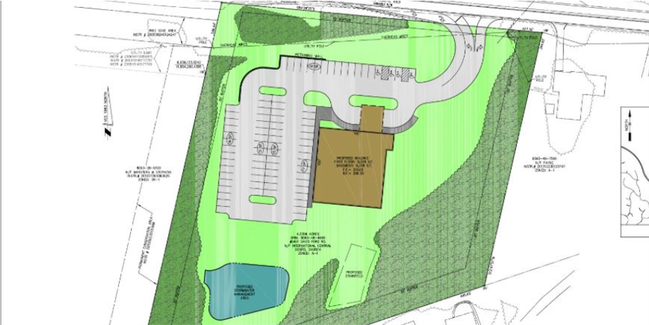
The slides above depict the revised application that was presented to MIDCO on November 16th. The new entrance has been moved to the west and redesigned. The building facade is now brown. There is no left turn entry to the property. The applicant has acquired the VDOT property at the front of the property, so the land area of the project is now 4.3 acres according to the applicant. The name used for this location would be "Transformation Temple International" as seen on the building. The link above is the Powerpoint presentation from the meeting.
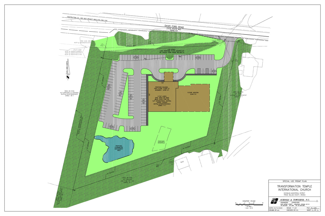
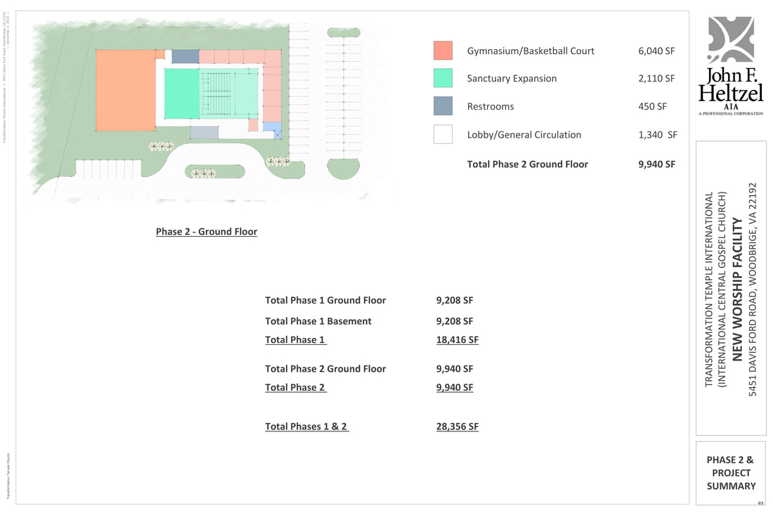
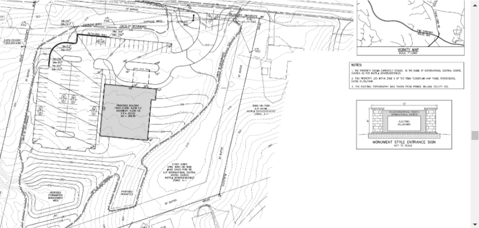
The proposal shown below is the original Special Use Permit application to build a 17,845 square foot church, a daycare/school and a banquet hall on 3.66 acres at 5451 Davis Ford Road. Future expansion to 28,356 square feet would include an expanded sanctuary and a recreational facility. The elevation in the area of the building is about 7 feet below Davis Ford Road. The buffers on the property are 30 feet wide. Some of the parking spaces at the front of the plan are on VDOT property and that property would have to be acquired by the applicant. The facility would be served by public water and a septic system as shown. The applicant has stated that the church currently has 150 members.
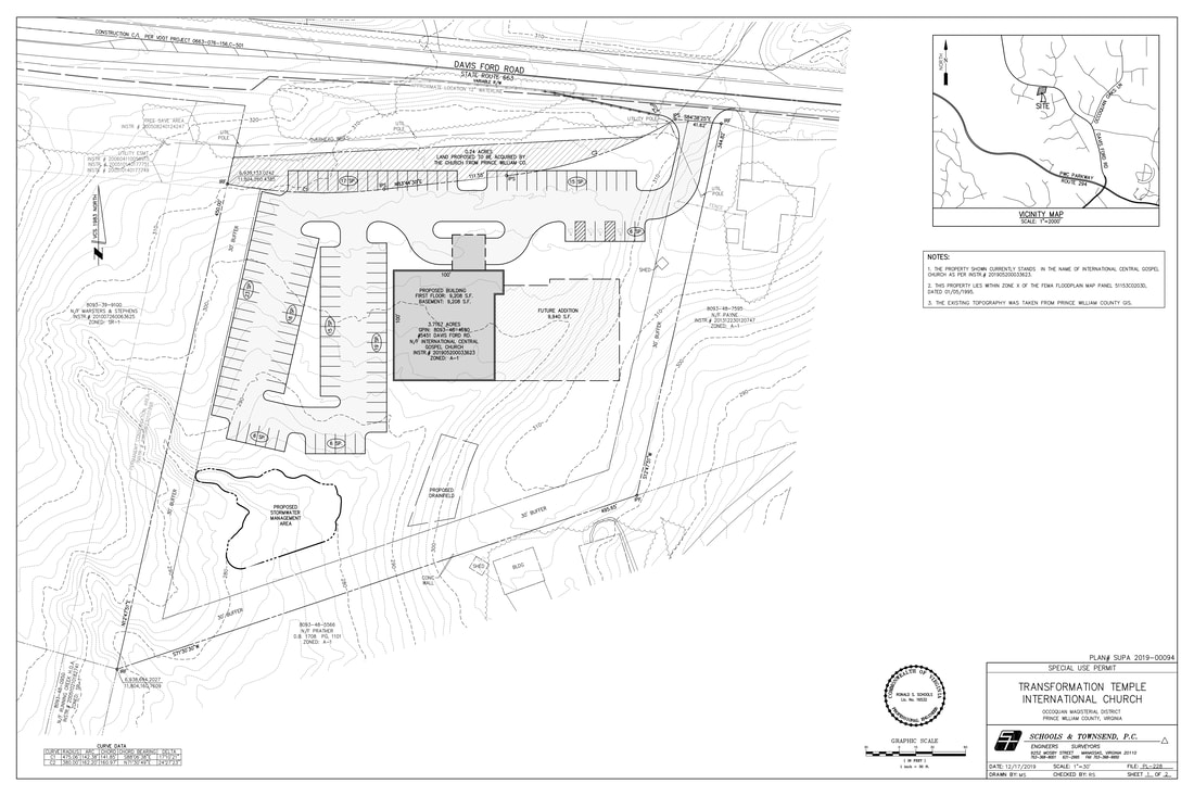
The proposal shown below is the original Special Use Permit application to build a 17,845 square foot church, a daycare/school and a banquet hall on 3.66 acres at 5451 Davis Ford Road. Future expansion to 28,356 square feet would include an expanded sanctuary and a recreational facility. The elevation in the area of the building is about 7 feet below Davis Ford Road. The buffers on the property are 30 feet wide. Some of the parking spaces at the front of the plan are on VDOT property and that property would have to be acquired by the applicant. The facility would be served by public water and a septic system as shown. The applicant has stated that the church currently has 150 members.